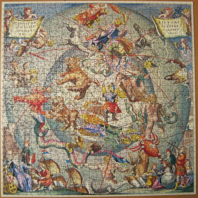
 992 Teile
Ancient Astronomical Map
Engraved by I Van Loon circa 1660
Original Chart by courtesy of the Raymond O'Shea Gallery
"This chart was first printed in the 1660 celestial atlas of Andreas Cellarius. True to the theory that geography is impossible without a proficient knowledge of astronomy, Cellarius, in this chart, superimposed the heavens upon a perspective of the earth which includes the Arctic Circle, parts of Europe, Asia, America and Australis, then called Nova Hollandia.
Andreas Cellarius was an obscure but interesting 17th century figure, born around 1630 in the German Palatinate. A writer of mathematics, history and architecture as well as a celestial cartographer, Cellarius was assumed to be Rector of the SCHOLA HORNANA in the northern Dutch town of Hoorne.
Cellarius is remembered principally for his great celestial atlas. It opens with one of the most ornamental frontispices ever executed. The following 29 charts with their sun, moon and planets, engravings of mathematicians, scholars, astronomers, signs of the zodiac and mythological beasts, illustrate the cosmological systems of Ptolemy, Tycho Brahe and Copernicus.
The 1660 celestial atlas of Andreas Cellarius is a magnificent example of 17th century astronomical cartography and is one of the era's finest displays of decorative copper-plate engraving and printing. The atlas was so successful, that it was reprinted in 1661 and 1708."
(information in bold letters taken from the box of an "Optimago" handcut wooden jigsaw puzzle with approx. 600 pcs.)

.jpg)


No comments:
Post a Comment